
Archives: Advance Page

Earthquake monitoring and tsunami warning
—
by
RIMES operates a 24/7 regional facility for earthquake monitoring and tsunami warning, with the following capabilities: Automatic seismic data acquisition system: Antelope and SeisComP are used as redundant systems Sea level data acquisition system: Global Telecommunication System (GTS) link through Maldives and customized Tide Tool run as redundant systems Database of pre-computed tsunami simulations Near…

Tool development
—
by
RIMES assists the Member States through the development of tools that facilitate the use of forecast products of different lead times for assessment of potential impacts and generation of guidance/ advisories. Tool customization integrates forecasts available from the NMHS and user requirements, determined through need assessments. Relevant national agencies co-develop country-specific tools. Tools are transferred…

Hydro-meteorological hazard assessments
—
by
RIMES assists countries in assessing the vulnerability of communities and infrastructure to natural hazards, determining their degree of exposure to future hazardous events, and develops risk reduction recommendations to be integrated into development planning processes. RIMES supports the development of methodology for hazard and vulnerability assessments; hazard assessment; assessment of vulnerability of populations and community…

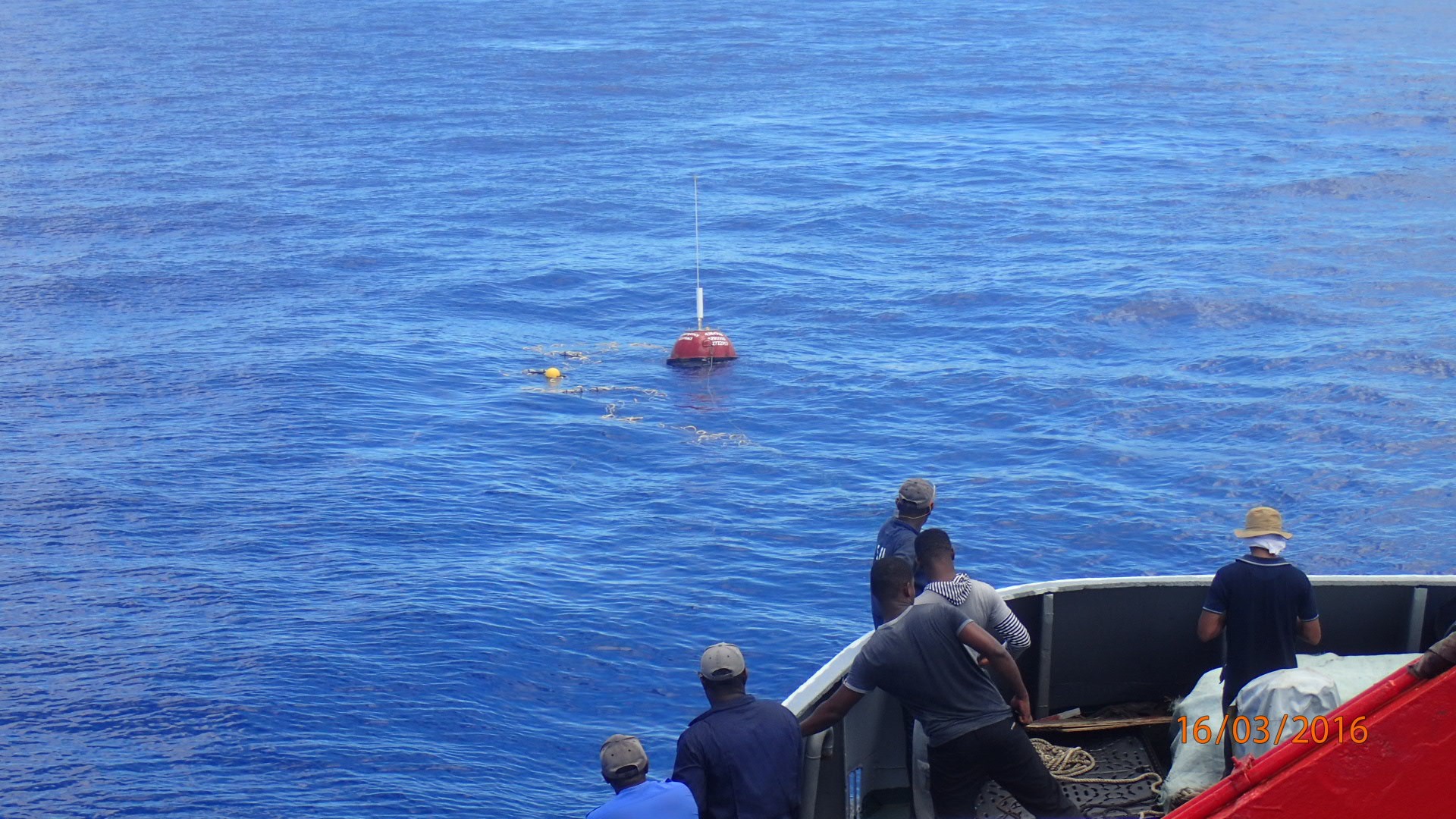
Support to NTWCs on potential earthquake damage, tsunami, and coastal inundation forecasts
—
by
RIMES supports National Tsunami Warning Centers (NTWCs) in assessing hazards, vulnerability, and exposure to potential earthquakes, tsunamis, and coastal inundations to assist in anticipatory actions. RIMES provides earthquake alerts and regional tsunami bulletins from its 24/7 regional facility for earthquake monitoring and tsunami warning. Within the framework of the Intergovernmental Oceanographic Commission of UNESCO (IOC-UNESCO),…

Downscaling climate projections
—
by
RIMES research on climate change deepens understanding of climate variability, potential impacts, and coping strategies RIMES identifies global climate models that are consistent with observed climate data and trends over the region. Dynamical and statistical downscaling techniques are then used to generate climate scenarios for selected time slices for the country. Evaluation is then undertaken…

Monthly and seasonal forecast information
—
by
RIMES assists countries, on demand, in the analysis of the climate outlook for the season. Forecast models from various global climate centers are analyzed against historical observations, for the selection of models that are consistent with local climatology. The seasonal climate outlook is generated using products from the ensemble prediction system, which are then analyzed…

Extreme weather information
—
by
During severe weather over the region, RIMES integrates the model with higher grid resolution, and severe weather information is provided to potentially affected countries. Model outputs are then used as inputs to appropriate storm surge and hydrological models for storm surge or flood prediction. Enhanced severe weather forecasts and integration into flash flood forecasting Depression…
Marine Forecasting
—
by
Reliable and accurate ocean information is critical for empowering users and authorities of island states and coastal areas to make informed planning and operational decisions. Through an effective early warning system, potential damage, exposure to risk and uncertainty is reduced and gives longer lead time for decision makers and communities at risk to plan anticipatory…
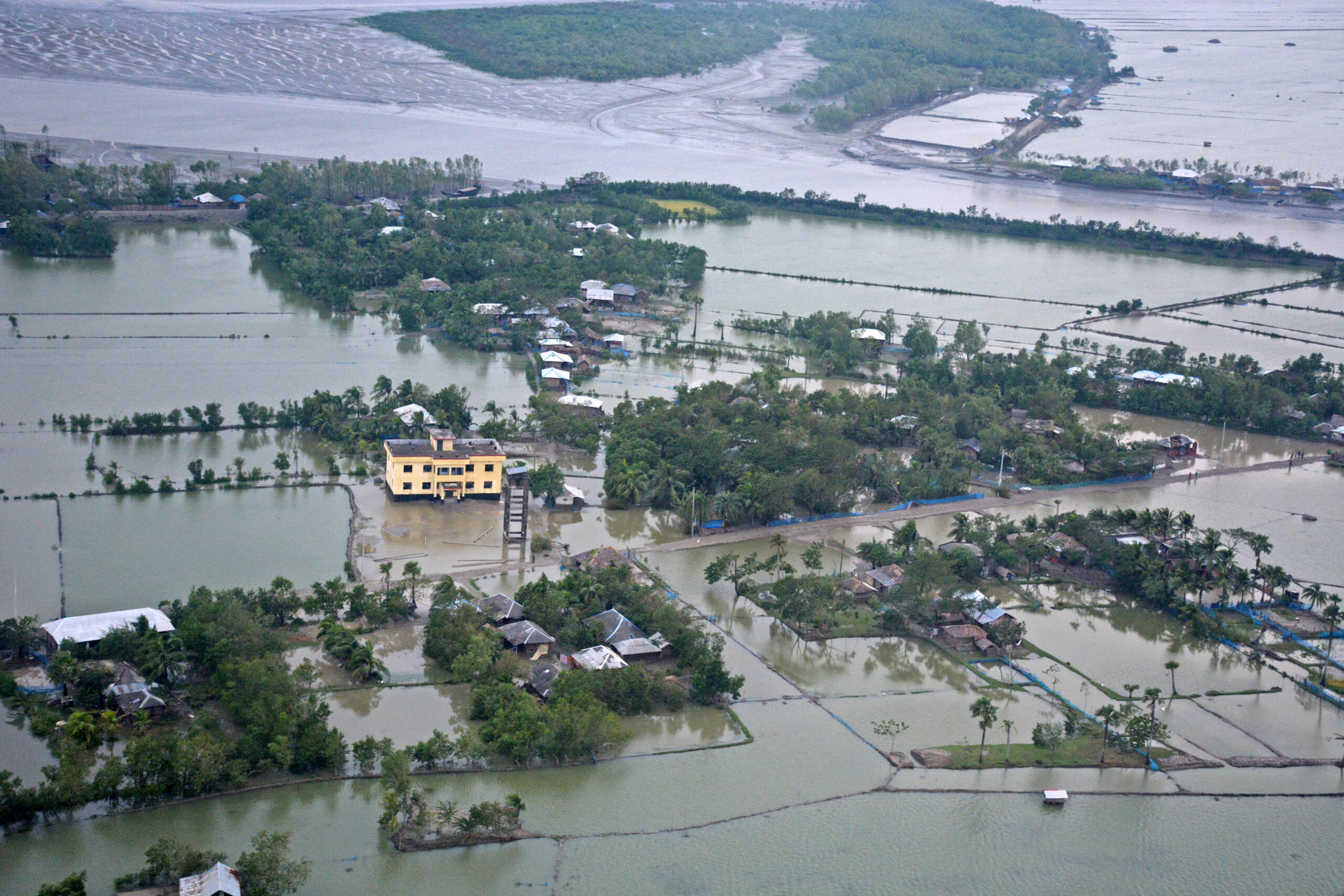
Flood Forecasting
—
by
Flood forecast information with sufficient lead time is critical to managing risks to vulnerable groups and reducing socio-economic impact. The Asia-Pacific region is home to large river systems with transboundary river basins that are prone to flooding, resulting in severe impact beyond geographical boundaries. The Indus, Ganges, Brahmaputra-Meghna, and Mekong, for example, are resources to…

High-resolution weather (up to 10 days) information
—
by
RIMES utilises research products available from global climate centres for improving resolution and lead time of forecast products resulting in longer-lead, high-resolution, site-specific hydro-meteorological risk information, required for contingency planning and resource management. RIMES facilitates generation and application of high-resolution weather information through: Development and pilot application of 10-day weather forecast Downscaling of global numerical…